
Trace a Yonkers Street by Address
The best street-by-street method is a record trail. Start with the physical address, establish the correct tax parcel, then move from municipal context to the county’s dated instruments. The property record may name an owner or mailing route. The recorded instrument may identify grantor and grantee. Historic directories may connect an address to a particular edition. Those are related facts, but none alone proves who currently lives at the location.
Use each step to carry a stable identifier to the next source. A print key, section-block-lot, or legal description can survive changes that make a postal address hard to search in older records. Stop when the evidence reaches its limit. The New York voter self-lookup is not a street roster, and a parcel map is not a household list.
- Find the Yonkers address in the city’s property tools and record the parcel identifiers or published SBL format.
- Check the Westchester municipal parcel viewer by municipality, address, print key, or owner where available, and compare the geometry carefully.
- Use those clues in Westchester Records Online or at the County Clerk Land Records counter to locate a dated instrument.
- For a past address, identify whether Riverfront has a reverse-address or criss-cross directory for the relevant year.
- Pair the address-era result with a newspaper, map, or later record instead of treating one result as a complete street history.
Yonkers Property Finder Starts Parcels
The City Assessment Department is the municipal starting point for a Yonkers street directory search. It creates the annual roll and directs users to online property information, tax maps, photographs, and sales material. Legacy Image Mate states that it provides RPS data, tax maps, property photographs, and final-roll access. Its published section-block-lot notation is 9.-9999-999.999, representing section, block, lot, and an optional second lot.
The City’s ArcGIS Property Finder configuration separately confirms property-address and owner-name discovery. Use it to identify a parcel. Do not treat that convenience as a historical title series. The assessment record is municipal property context at a given time. A recorded county instrument is needed for a transfer trail, and the County Clerk counter remains the official record access point.
The Yonkers Image Mate property-viewer entry is the official source represented in this image.
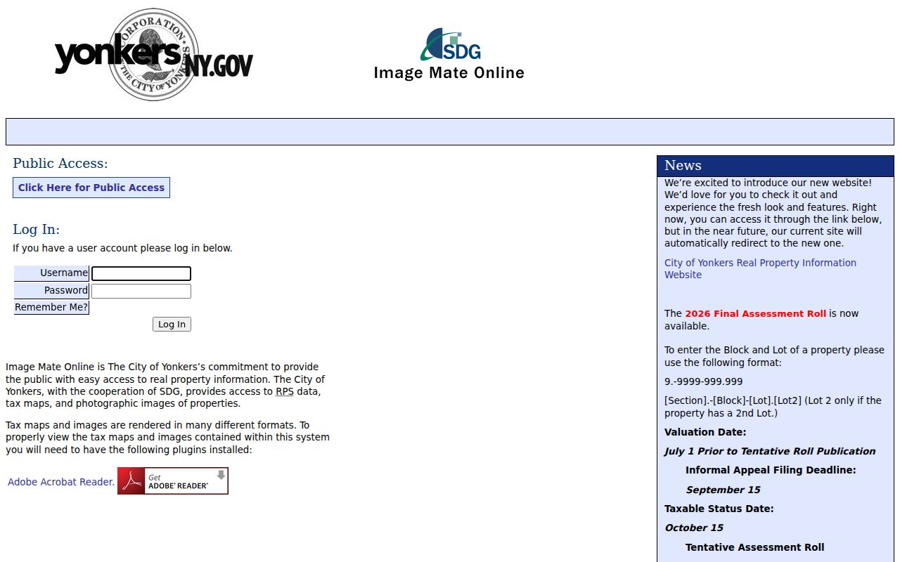
The Image Mate screen shows the city’s property-research entry. It can begin an address trail, but it does not replace a later deed check or establish the people currently connected with a Yonkers street.
Yonkers Street Search Fields and Layers
The Westchester Municipal Tax Parcel Viewer is a separate county reference layer. Its documented route starts with a municipality, then allows parcel identification by address, print key, and owner where available. It also supports map printing, query-result export, and abutters mailing labels. Its Yonkers layer can display municipal name, SWIS, SBL, print key, situs fields, owner-mailing fields, property class, school fields, and geometry.
The viewer is useful for locating the correct polygon along a street. It is not a survey, a definitive boundary description, or title proof. The published service caps queries at 2,000 features, and a listed field may be blank for a particular parcel. Use approved tax maps from the local assessor when an authoritative tax-map reference is needed.
| Viewer field or control | Type | Required | Verified use or format |
|---|---|---|---|
| Municipality | Selection | Not stated | Select a municipality before locating parcel data |
| Address | Address lookup | Not stated | Find the parcel tied to a street location |
| Print key | Parcel identifier lookup | Not stated | Carry city or county parcel context into map review |
| Owner name | Name lookup where available | Not stated | Reference field only, not proof of residence |
| Print or export | Output controls | No | Create a map or export query results |
Yonkers Street Addresses Have Two Roles
One Yonkers street address can appear as a situs location and as part of a different mailing record. The county parcel schema makes the distinction plain: it has property-address fields as well as owner-name and owner-mailing categories. A current tax parcel reference can therefore show that a property exists at an address without establishing that every listed owner or contact receives mail there or occupies it.
A parcel is the tax-map unit. A situs address is the physical property location. A plat is a mapped division or depiction of land. A criss-cross directory is a dated address-oriented directory. These terms help sort sources by function. They also keep an address research result from being turned into a person claim that the record does not make.
- Parcel
- The tax-map property unit, commonly identified with SBL or print-key information.
- Situs address
- The physical address carried for a parcel.
- Plat
- A map or plan showing land divisions and related location details.
- Criss-cross directory
- A historical directory arranged for address-based research.
Note: Owner, mailing recipient, directory entry, and deed party are distinct roles that must be kept separate in a Yonkers street search.
Yonkers Records That Follow Addresses
Several Yonkers record systems use an address or parcel as a useful entry point. Their results differ in time, access, and meaning. Municipal tools are best for the property reference. County land records are best for dated instruments. Library collections are best for historical address context. The voter service has an important boundary: it lets a registered voter confirm their own record and does not provide a public street-browsing function.
Read the table as a chain, not as a master street directory. A parcel identifier can connect municipal and county work. A legal description can reach past a changed address. A dated reverse directory can add a historical listing. No record set below creates a current household roster.
| Address-keyed source | Custodian | What it shows | Access boundary |
|---|---|---|---|
| Assessment roll and Image Mate | Yonkers Assessment Department | Municipal roll, tax-map, RPS, and property-photo context | Dated municipal property reference |
| City Property Finder | City of Yonkers | Property-address and owner-name discovery configuration | Not a historical ownership series |
| Municipal tax parcel viewer | Westchester GIS and local assessors | Parcel geometry, situs, and owner-mail categories | Approximate boundaries, not a survey |
| Recorded land instruments | Westchester County Clerk | Dated parties and legal-description clues | Online database is a convenience layer |
| Property-information gateway | City of Yonkers | Advertised permits and board approvals | Public query fields and coverage unverified |
| Riverfront directories | Yonkers Public Library | Dated address-oriented historical listings | On-site reference access and collection gaps |
Westchester Deeds Outlast Street Labels
Use Westchester Records Online Land Search after the parcel work supplies an address, SBL, print key, legal-description clue, or party name. The Clerk describes its system as a public convenience database spanning deeds from the eighteenth century to recently entered legal records. That broad statement does not promise that every historic book, image, document class, or search field is equally available online.
When an instrument is found, retain the grantor and grantee, recording reference, parcel data, and legal description. An earlier deed may omit the modern postal address, so search the parties and legal description rather than the street text alone. General information is available at no cost, while the published WRO terms require an account and payment to view images or reports. The research did not inspect authenticated Land Search fields or copy charges.
Yonkers Permit Gateway Has Limits
The Yonkers Property Information Gateway advertises city property records, building permits, and board approvals. It begins with prior-use and category choices before a Yonkers route. That makes it a worthwhile official place to check for property-file context after the parcel is identified. It does not support claims about an unverified address filter, permit-number filter, year range, result column, or historical completeness.
Historic property files are being digitized. The city directs a researcher to locate the block and lot and make an appointment for assistance. That counter route is more reliable than guessing what a portal may include. The city’s Tax Department also has a paid research fallback for property-tax information when an online screen is not enough.
The official Yonkers permit gateway is shown in the following reference image.
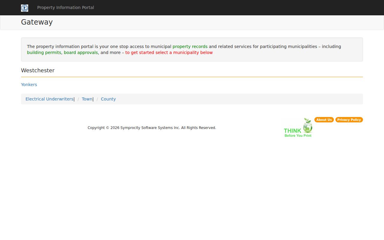
The gateway image confirms the city’s entry point for property records, permits, and board approvals. It does not establish the scope of any later search form, so address research should preserve that limit.
Yonkers Street Directories Carry Dates
For an older Yonkers street directory question, Riverfront’s exact directory holdings matter. The Library documents reverse-address material for 1895-1900 and 1900-03, along with criss-cross editions for 1931, 1936, and 1939. Those are the editions designed to start from an address. Alphabetical directories answer the different question of where a known name was listed in a particular year.
The Yonkers Public Library city-directories inventory also documents gaps. Microfilm begins at 1860-61, then has breaks before a longer imperfect run through 1939. The materials must be used at Riverfront. When no reverse directory exists for the target year, use an alphabetical edition, recorded deed, map, or local-history staff assistance instead of inventing a continuity that the collection does not provide.
Sanborn Maps Place Yonkers Streets
Maps help explain the built setting of a Yonkers street, not the people who used it. Westchester archival inventory identifies Yonkers Sanborn holdings from 1886, 1898, 1917, 1917 updated to 1951, and 1957. The Library of Congress also provides a 1917 volume with 126 sheets. Use a sheet alongside a dated directory or deed to understand structures, block layout, and address-era context.
County parcel geometry and a Sanborn sheet describe different time layers. The current map provides a reference parcel and approximate boundary. The historic map captures built environment at its own publication date. That comparison is useful for family history and property curiosity, but it does not bridge the years into a claim about current residents.
Request Yonkers Land Records Directly
When an online result is incomplete, send the request to the Westchester County Clerk Land Records Division, not through a general FOIL route. The Clerk specifically directs deed and land-record requests to Land Records. Give the grantor or grantee, recording date or range, legal description, and SBL, print key, or address if known. Ask which plain or certified-copy route applies and for the current fee before copying.
The Land Records office is at 110 Dr. Martin Luther King Jr. Boulevard in White Plains, with main telephone 914-995-3080. The County Clerk notes that staff cannot provide title or legal advice. A certified copy is the legally equivalent copy when that status is needed. The Westchester County Archives reading room is the additional path for original recorded deed books and other historical county material.
Limits of a Yonkers Street Directory
A Yonkers street directory can identify a parcel, a recorded transfer, a dated directory listing, or a map context. It cannot establish every person connected with an address. Map owner fields, mailing fields, and deed parties have distinct roles. An empty online result can also reflect digitization gaps, access restrictions, or a source that never indexed that type of record. Respect those boundaries rather than trying to defeat them.
The New York voter lookup illustrates another hard limit. Its form requires county, name, date of birth, and ZIP information for an individual’s self-service confirmation. It is not a street-by-street directory. Broader voter-data requests have an elections-purpose restriction and confidential voter status can properly keep records out of ordinary disclosure.
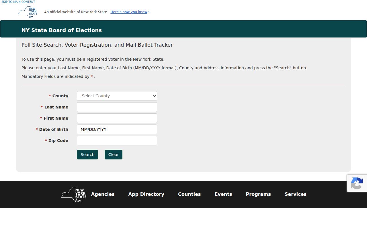
The form image reinforces why a Yonkers street search should use address-keyed property and historical sources rather than treat a personal voter tool as a block roster.
Lawful personal use. Use Yonkers address records for limited, legitimate research and never use a record to stalk, harass, threaten, impersonate, or evade a protected address.