
Yonkers Neighbors by Block Source
Each source answers a different block question. The City Property Finder and County municipal parcel viewer help identify parcels. Assessment material provides a dated municipal reference. Historic reverse directories can show a printed address association in selected years. Civic organizations offer local context, not membership rolls. The distinction between owner, mailing recipient, directory entry, and resident must remain clear at every step.
| Source | What It Shows About a Block | Access |
|---|---|---|
| City Property Finder | Property-address and owner-name discovery configuration; a city-owned 2023 ownership layer with parcel and owner-mail categories | Public city application with its stated disclaimer and no-solicitation condition |
| Westchester municipal tax-parcel viewer | Candidate parcels, print key, situs, owner/mail fields where populated, property class, and geometry | Public map viewer after selecting Yonkers |
| Yonkers assessment roll | A municipal property snapshot by published roll year | City roll and property-information route |
| YPL reverse and criss-cross directories | Dated address listings for selected historical editions | Onsite Riverfront reference collection |
| Police-precinct community pages | Community-council and association context | Public city information, not a member directory |
New York's voter self-lookup is not included as a block-search route. It is designed for a registered voter to confirm their own information, and wider voter-registration data have an elections-purpose restriction. A block map should not be reworked into a voter roster.
Yonkers Neighbor Roles Are Different
The county parcel layer explicitly separates property situs from owner and owner-mailing fields. A property record may be blank or out of date, and it cannot show every person at that address. A recorded deed shows a dated transfer, not a current household. A historic directory records a published association for its edition year. These differences are not technical details. They prevent a nearby parcel from being mislabeled as a neighbor list.
| Official parcel and roll records | Useful for parcel identity, map orientation, and dated owner-related facts; custody and source date are visible. |
|---|---|
| Commercial neighbor-finding category | May be convenient, but its collection method, refresh date, identity matching, and error correction are often less clear. It should not replace the responsible custodian. |
| Historical publications | Useful for an address-era clue when the exact edition exists, but not for present identity. |
Use official records for the narrow question they actually answer. If a complete named-street record chain is needed, the Yonkers street directory route follows the broader address workflow.
Mapping Yonkers Neighbor Parcels
The verified nearby-parcel method is visual and manual. After choosing Yonkers in the county viewer, find the target by address, print key, or owner name where available. Select the target parcel, inspect the touching or nearby polygons visible on the map, and open each candidate individually. No current verified radius, buffer, or automatic-adjacency control was found, so none should be assumed.
- Search the target location in the City Property Finder or county municipal tax-parcel viewer.
- Record the property address, municipality, print key or SBL, and source date before moving outward.
- Visually inspect the touching or nearby polygons displayed on the map, selecting each parcel one at a time.
- Read the published parcel attributes and distinguish situs from owner mailing fields.
- Use the assessment roll or a recorded instrument only to test the limited property fact it records.
The county viewer can print maps, export query results, and produce abutters mailing labels. Those functions support property-notice work, not personal outreach. Its parcel boundaries are approximate, and authoritative approved tax maps remain with the local assessor.
For a tax or assessment question that cannot be resolved on screen, Yonkers also states that tax information can be researched online without charge and that public computers sit outside the Tax and Cashiering Offices in Room 108. The Tax Department offers research at $5 per property per year, with payment before research and a stated two-to-three-week lead time; it does not provide that information by telephone or email without the processed fee. This is an office fallback for the property record, not a route to identify every neighbor.
Yonkers Neighbor Parcel Fields
Westchester's published municipal layer provides a useful field inventory. It permits the same parcel to be described by stable identifiers and location fields without claiming that the parcel names all occupants. A field can be part of the layer schema without being populated for every feature, so blank values should not be filled by inference.
| Field group | Examples in the published layer | Careful block use |
|---|---|---|
| Parcel identity | SBL, PRINTKEY, SWIS, MUNNAME | Carry a property reference into assessment or deed work. |
| Situs location | PROPADDRESS, PROPAPT, PROPCITY, PROPZIP, LOC_ST_NBR, LOC_STREET | Confirm which parcel corresponds to a street location. |
| Owner or mail route | OWNERNAME, OWNERADDRESS, OWNERCITY, OWNERSTATE, OWNERZIP | Keep mailing and property locations separate; neither proves occupancy. |
| Map context | PROPERTYCLASS, school fields, geometry | Read parcel context, not personal identity. |
Westchester's tax-map service is the source for the viewer's access path and boundary caution.
Park Hill Context for Yonkers Neighbors
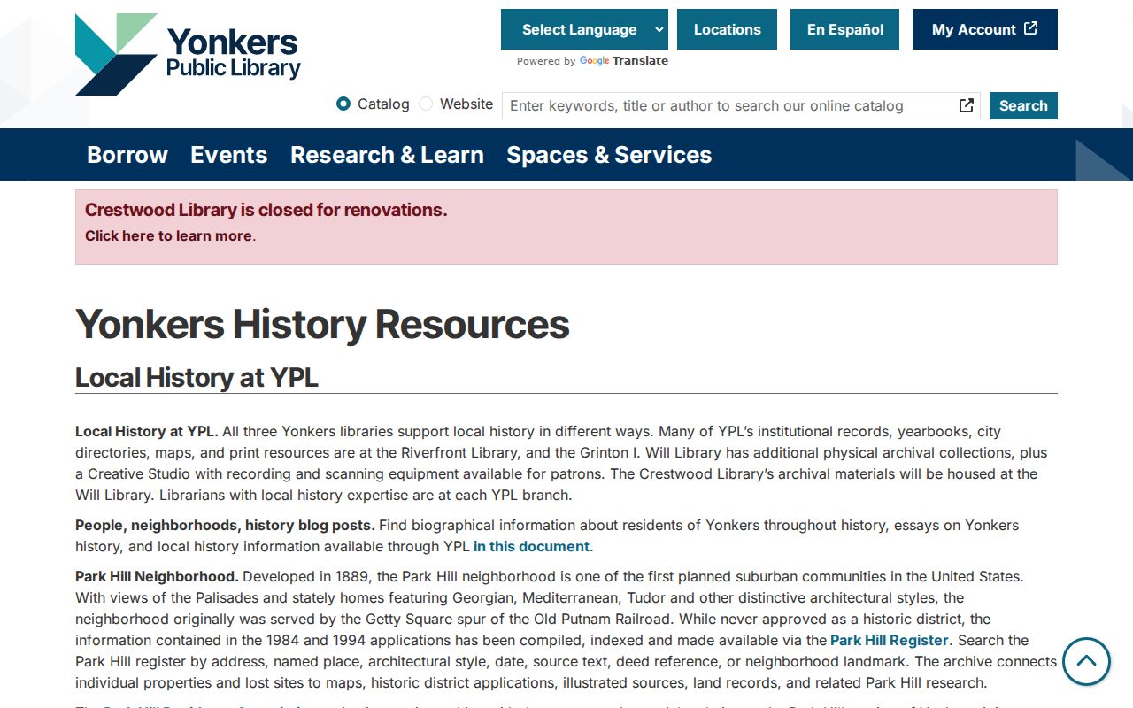
For some blocks, a place-based record gives better context than a person-oriented search. YPL's Park Hill Register can be searched by address, named place, architectural style, date, source text, deed reference, and landmark status. It connects neighborhood history with primary deed references, but it remains an index and context layer rather than a title report or a current resident list.
YPL's Yonkers history resources introduce the Park Hill Register and its search categories.
When a Park Hill result contains a deed reference, use it as a lead to the County Clerk's land-record route, and keep the register's date and source-text context attached to the note.
Yonkers Neighbors in Dated Directories
YPL's Riverfront Local History Room supplies a historical block layer where an applicable edition exists. Reverse-address material is documented for 1895-1900 and 1900-03, and criss-cross directories are documented for 1931, 1936, and 1939. They can supply a printed address-oriented clue for those periods. The broader directory run is incomplete and onsite, so a missing listing cannot establish that a particular person was absent.
Riverfront's reference material does not circulate and the room is not freely accessible. Arrange access through localhistory@ypl.org or 914-375-7966, identify the date range and address, and ask which edition is available. The library also provides onsite historical research resources subject to its access rules. That access channel is important when an old block question cannot be answered by a current map.
Use a directory year with a contemporaneous map or newspaper before connecting it to a person. Westchester Archives identifies Yonkers Sanborn map holdings for 1886, 1898, 1917, 1917 updated to 1951, and 1957. The maps explain building and block context, not household identity.
Yonkers Neighborhood Map Areas
Yonkers publishes a Neighborhoods ArcGIS item with 38 named map areas, including Park Hill, Getty Square, Crestwood, Ludlow Park, and Lincoln Park. These labels can add geographic context to a block inquiry. They are city map classifications, not a promise of legal boundaries, resident rosters, or postal service areas.
ZIP codes need the same restraint. They are mail-routing tools, while Census ZCTAs are generalized statistical approximations. A current mailing question belongs with USPS address lookup. Parcel maps and the city neighborhood layer are better tools for geographic orientation, and neither determines who lives at a particular address.
Yonkers Civic Groups as Context
Local organizations can point a researcher toward public meetings, community issues, or neighborhood history without acting as a contact list for neighbors. The city police precinct pages provide this sort of context. Use the page that fits the relevant area, and do not infer membership or household status from an organization mention.
| City context source | Research finding | Appropriate use |
|---|---|---|
| First Precinct community page | Reports a community council and 21 homeowner associations. | Context for public community activity, not association membership. |
| Fourth Precinct community page | Identifies the Hudson River Community Association, Lake Avenue Merchants Association, Downtown/Waterfront BID, and its council. | Local civic and business-district context, not a people directory. |
| Park Hill Association and Lincoln Park Civic Association | Published material describes events, newsletter, or membership and boundary processes. | Check organization pages for public activities; do not treat lists as household data. |
Neighborhood groups are most useful as a bridge to public context. The research did not identify a lawful public roster for browsing people by block.
Privacy Limits on Yonkers Neighbors
Some addresses are properly absent from ordinary public disclosure. New York's Address Confidentiality Program provides qualifying participants a substitute address and mail forwarding under Executive Law section 108. Agencies generally must accept that substitute address unless the Department of State grants a written waiver, and released records must redact the actual address when a waiver holder has it. Confidential voter status is also available to qualifying people through the county board.
The City Property Finder's own disclaimer and no-solicitation condition are further boundaries on map use. Certified vital records, sealed court records, youth and family material, protected voter data, and ACP-protected addresses each have separate access rules. A public map or old directory is not permission to publish, watch, or contact a person.
Lawful use. Use Yonkers neighbor research for block context, community history, or personal curiosity. Do not use it to monitor, intimidate, threaten, or harass anyone, and do not try to bypass a protected-address or confidential-record safeguard.